Monday 30 April 2012

Clunters Gill to Gragareth

Parked at Clunters Gill bridge at the head of Kingsdale
and set off through the wood


out of the wood
went left to follow the wall up

Bahhh!
Inglebourgh comes into view
Lichen on the wall
and an old wood cart ? chassis
 follow the wall uphill
looking back
plod on, the wind was getting strong but blowing behind
 at the top Pheww ! needed a blood transfusion
followed the wall left to keep out of the wind , the Bear opened the Bistro at 2005 feet, lamb and mint
burger, petite pois, baby carrots, mashed potatoes and a 2009 South African Pinotage Rose.
looking back to see Penyghent and Inglebourgh
and Whernside
headed for the high ground to find the Trig. but it was super boggy (think being found in 2000 years as a leather peat bog man)


Here's one for Steve (Fell Finder) and Mark (Beating the Bounds) Gragareth Trig overlooking Arnside Knott
the wind was gale force

back to the top wall over looking Braida Garth farm to the Limestone pavements on Scale moor and over the valley to Raven Scar on Inglebourgh
and Whernside
with a tele-photo of Penyghent
and looking down on Ingleton
 Steep !
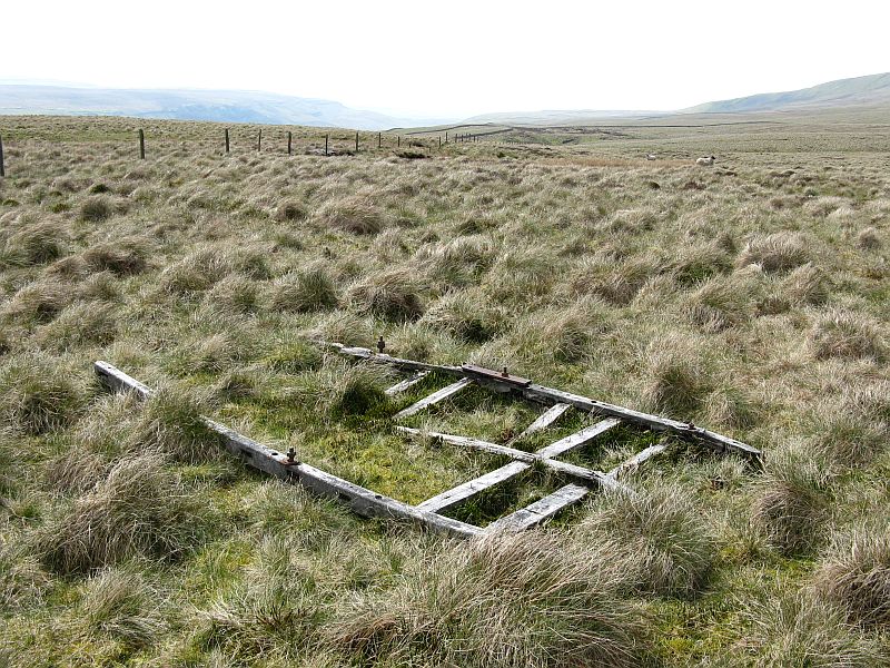
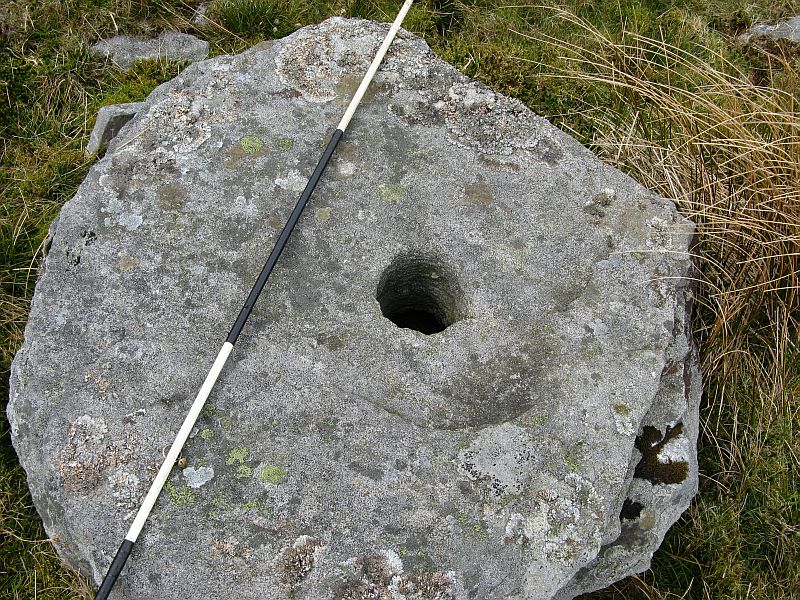
and down through the Milstone grit which has been worked since Neolithic times


managed to find a damaged one


final views of Inglebourgh
and Whernside with cloud forming on top
then back down to the car and a drive down Kingsdale with photo's of the dry river bed 


it only flows after high rain when in flood the rest of the time it's underground to re-appear at Keld Head
final shot before main road and home
just thought I'd share cheers all Danny


Friday 27 April 2012

Hunters stone and Tor Dyke

Just for a change it wasn't raining so set off via Thornton, Skipton by-pass,,Rylstone,Cracoe, Threshfield and stopped outside the Tennant Arms at Kilnsey
 we were too early though so after looking at the beck
we set off for Kettlewell
just opened we were the first served
while Brenda and the Bear had a pint I took some photo's


then set off on the Coverdale road and up Park Rash, passing a limekiln on the right
 and a Teuchat (it was wearing a kilt !)
before arriving at the Hunters stone
 which marks a route used by the Monks from Coverham abbey to Kilnsey, and the Drovers


small stone cairn with fresh cut Holly around just to the side ?
back to the P on the map and park just before the cattle grid
with a view down Wharfedale
looking towards Great Whernside along Tor Dyke http://www.brigantesnation.com/SiteResearch/Iron%20Age/Tor%20Dyke/TorDyke.htm

then back over the road and along the Bridleway towards Starbotton

looking back at the Dyke


 carried on along the top, on the track - over looking
and here's a first
the track then got wet !


with either a rescue or training over towards Gt. Whernside

left Brenda on the track and set off to find the long barrow I was looking for
with an Owl hawking up and down and getting mobbed by a Curlew and Lapwings
 had a look for but couldn't find Shorn Cross. I'll have to do some more research
then back to the track passing a small pond (left of red flag) one for Mark (gauntlet ?)
then back along the track

 to the car
and back down Park Rash


and into Kettlewell
just as it started to drizzle, just thought I'd share cheers all Danny